QUESTIONS ABOUT MID-MONTH PATTERN
For much of the next week here in Wichita, we will be looking at gradually increasing temperatures and chances for storms. Will the pattern change and do we have any cool downs in store for us? Lets take a look.
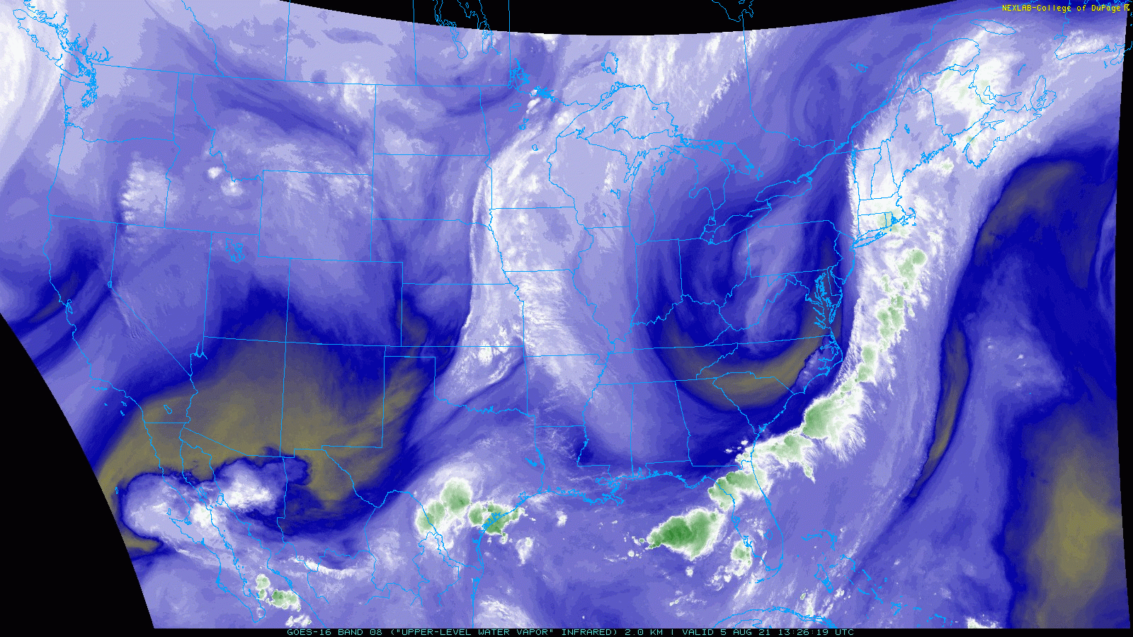
Multiple waves of energy look to traverse the US through the end of this week and into the weekend. Looking at water vapor imagery this morning, you can make out multiple pieces of energy with the most organized looking system being located in the East. There is also another piece currently pushing onshore in the West. This will be what brings the Plains to Upper Midwest severe weather chances this weekend.
Zooming into this severe weather threat would show that there is a decent setup. That aforementioned wave moving onshore in the West will progress eastward, with the GFS showing its position to be titled from east Kansas through southern Minnesota Saturday evening. Coupled with upper level divergence present, these two mechanisms will provide appreciable amounts of lift to promote thunderstorm development.
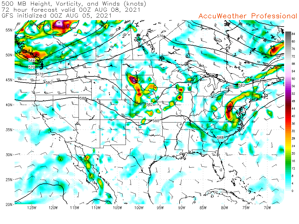
With respect to moisture and how buoyant the atmosphere will be. There are a few things which are going to allow air to rise. First off, dew points in the 60s-70s coupled with diurnal heating is going to push CAPE values at least into the 1000-2000 J/kg range. Areas of higher instability will be present across southeast Kansas through south-central Iowa.


On top of this, dry air at 700 mb will continue to promote upward motion via latent heat release.

As storms develop on the front, northwesterly shear coupled with the movement of the shortwave being zonal (west to east) will push storms east-northeast. Storms will continue through the overnight into Wisconsin given the presence of a LLJ. These overnight storms could bring much needed rain to portions of northern Iowa where portions of the area are experiencing extreme drought.


Beyond Saturday, the weather will remain mostly clean through much of the next week.
The next significant chance of rain will be next weekend as a cold front attempts to push through the Central Plains. Currently, there is agreement from model output that storms will occur either Saturday or Sunday. The questions are, does the front move through and cool us down? OR do we go right back to the pattern we have been dealing with?
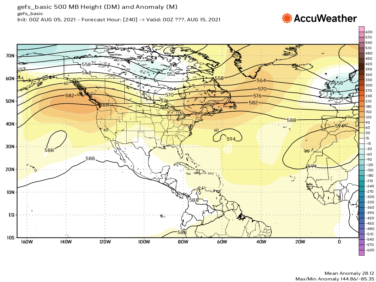
Looking at what the disagreement is, you can see below that the GFS has a more anomalous trough across the High Plains and Prairies while the Euro has substantial ridging setting up into the Northwest.


There are big implications here as the GFS would usher in cooler temperatures while the Euro would keep us in a similar pattern to what we’ve been seeing most of the summer (gradual warming, large cold front, gradual warming, so on so forth…). Ensembles would side with the Euro idea. The 00z GEFS mid level heights so a pattern that is more indicative of what the operation euro is putting out than what the GFS is.
Another thing to consider and monitor going forward will be the impact of the tropical Pacific on the mid level pattern across the US mid to late month. Currently, there is a storm moving up west Asia. The remnants of this storm will make its influence on the US about a week later. Perhaps the GFS is onto something here.
However, I like the placement of the blocking ridge in the northeast Pacific. There will also be multiple storms impacting the east Pacific which should act to enhance the ridge to the north.

Perhaps a blend of the Euro/GFS is what is preferred. Namely that a trough will dig into the US but will kick more into the east rather than the High Plains and Prairies. This is what the EPS hints at which means much of the same pattern moving into late August.

Good news with that is for July through August, we have been 2.8 degrees below normal. We also have only got 1.2 inches of rain which is making it dry out. This will make being outside enjoyable compared to usually being roasted out by this point in the summer.